
|
|
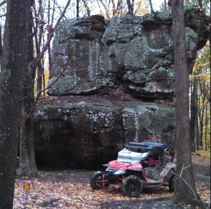
Brimstone
We have been riding Brimstone for over 5 years, they have approximately 150 miles of trails ranging from gravel roads to extreme. The extreme trails typically have one or two obstacles that make them extreme and otherwise are not to difficult. They maintain their trails throughout the year although it can take a while and they tend to get a little rough during the winter and spring.
Our ATV Trail Maps show all trails on their printed map plus some. Our color codes and trail numbers match theirs. The staff is extremely helpful and they offer a recovery service if needed. Views from the trails are excellent with several waterfalls and high overlooks. Their Campground is clean and easily accessible. It will support very large rigs. Brimstone typically has 2 big events(White Knuckle event and Brimstone Paragon) per year and 2 smaller ones (Winterfest and the fall color ride) which are open to everyone and have guided rides. You can spend weeks riding the trails and see a little bit if everything. Centrally located to the other three main trail systems, Brimstone is a great central point for riding hundreds of miles of trails. |
|
|
Windrock
Windrock has over 300 miles of trails ranging from Gravel roads to extremely difficult. They also have a mountain bike area as well as trails well suited to rock crawlers.
Trail maintenance is ongoing but can take a while and they also tend to get a little rough during the wet seasons. Our ATV Trail maps show all trails on their printed map plus several and our trail numbers match theirs as well. our coloring is somewhat different since Windrock uses a "Black Diamond" system that does not show up well on most mobile devices. Their black trails are Red on ours and their double diamond trails are red and end with YY on ours. The staff has always been exceptionally helpful, buy permits at the general store. Their campground is large and spacious with plenty of room for the biggest rigs. If you have a weak clutch in your tow rig, beware - it is an impressive hill to get up there. |
|
|
Sundquist unit TWRA (Royal Blue)
There has always been confusion about the actual naming of this area, some call it Royal Blue, some call it Ride Royal Blue but, it is actually the Sundquist unit of the TWRA North Cumberland WMA.
There are about 130 miles of trails. The maps identify them as easy to most difficult(1). Trail maintenance is done by TWRA and is ongoing. They can get very rough during the wet season and toward the end of the riding season. There are several campgrounds that support the area - check them out in our campgrounds page. |
Tackett Creek
Outstanding views and great trails. A little tougher than the other trails on the east side of I75.We include these with the Sundquist map set.
|
TWRA West (Royal Blue Unit/New River Unit)
The Royal Blue and New River Units of the North Cumberland WMA are on the West side of I75 and stretch roughly from Hwy 63 South to the Windrock boundary.
There are approximately 150 miles of trails here and they range from gravel road to extreme. They are maintained by TWRA and maintenance is ongoing. During the wet season, they can get very rough. As a general rule the trails are smoother than the other areas. There are several great waterfalls as well as the eternal flame, Dragons back, Widow Maker, Sand Mines and several great high views There are several campgrounds that support the area - check them out in our campgrounds page. |
Blue Holler - Mammoth Cave KY
Pickett State Park - Allardt, TN
Indian Mountain - Cherokee County, AL
Top Trails - Talladega, AL
Rush Offroad Rush, KY
Hollerwood
MineMade